One colour
and a wide spectrum of Earth monitoring solutions
and a wide spectrum of Earth monitoring solutions
| Image Processing | Image Analysis | Photogrammetry | IDL Programming | GIS and decision-making |
|---|---|---|---|---|
| Geometric correction, Orthorectification (ENVI Robust Ortho for satellite/manned aircraft imagery and ENSO Mosaic for manned aircraft/UAVs | Spectral/textural image analysis (ENVI) | Image mosaicking (ENVI for satellite/manned aircraft imagery and ENSOMosaic for manned aircraft/UAVs) | Expand ENVI functionalities with IDL | ENVI to ArcGIS interoperability |
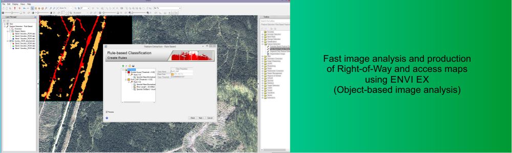
| Enhancement (Radiometric and atmospheric correction with ENVI) | Object-based image analysis (ENVI FX) | Digital Elevation Model Extraction
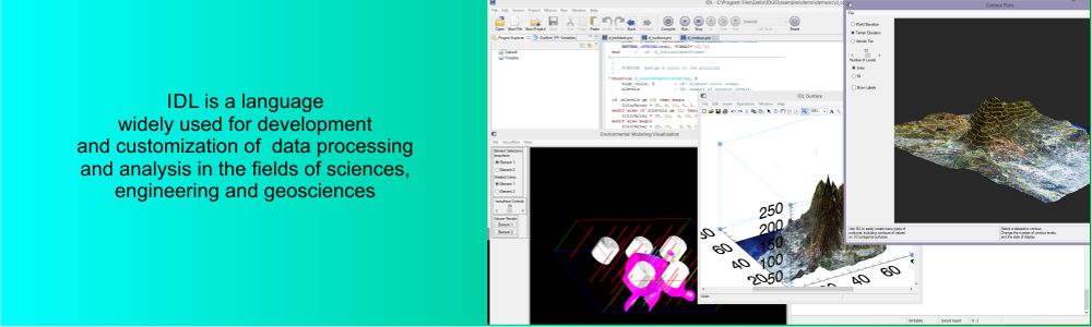
and 3D vision (ENVI DEM Extract) | Automate and batch your workflows | Geospatial layer Import/Export formats |
| Lidar data processing (ENVI Lidar) | Lidar analysis (ENVI Lidar) | Digital Elevation Model Extraction and 3D vision for UAV (ENSO Mosaic) | Access to an extensive collection of geospatial and mapping tools | ENVI Interface to third party using IDL |
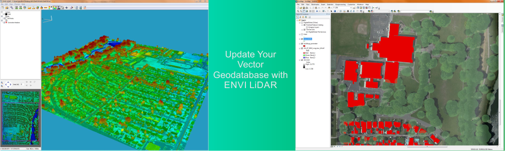
| Synthetic Aperture Radar (SAR) data processing (SARScape) | Synthetic Aperture Radar (SAR) data analysis (SARScape) | Synthetic Aperture Radar (SAR) DEM extraction (SARScape) | IDL Virtual Machine (VM) for distributing your IDL programs and projects | Layer stacking of rasters and vectors to a GeoDataBase |
ENVI products create the premier geospatial software foundation to process and analyze all types of imagery and data such as multispectral, hyperspectral, LiDAR, and SAR.
The ENVI Platform fully integrates with ArcGIS® from Esri, allowing you to add more information than ever before to your GIS for more powerful geospatial products.
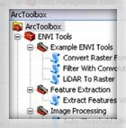
In just one click, push ENVI forArcGIS® results into ArcGIS for Desktop. Upon installation, over 20 prebuilt image analysis tools are automatically available within the ArcToolbox™, letting you easily add analysis capabilities to your GIS models and applications. ENVI image analysis tools are easy to learn and use, so you can create maps and other geospatial products for better and more informed decisions.
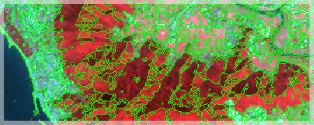
Find and extract specific objects of interest from all types of imagery with the ENVI Feature Extraction Module (ENVI EX). User-friendly tools enable you to extract features from geospatial imagery based on the object’s spatial, spectral, and texture characteristics and identify them as objects like vehicles, buildings, roads, coastlines, rivers, lakes, and fields.